August 29, 2019
Welp, a year has gone by and I am beginning the second year of my PhD. From reading many scientific articles, attending the Cornell satellite remote sensing course, and participating in various trainings at remote sensing workshops and symposiums, I am more knowledgeable about the satellite remote sensing field and feel better prepared and confident to share it with others. Therefore, my next several blogs will focus on some of the basics of satellite remote sensing that I’ve learned throughout this past year. Since my focus is on ocean color, I will not be including much on satellites for terrestrial or meteorological uses.
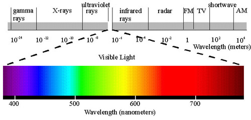
Remote sensing is the ability to collect information without making direct contact with the object studied. Earth observing satellites are typically polar-orbiting satellites for global long-term observations of Earth. Sensors onboard satellites measure different sections of the visible, infrared, and microwave regions of the electromagnetic spectrum.
Sensor resolution: Satellite sensors (i.e. spectrometers) all have different resolution capabilities depending on the purpose for which each was designed.
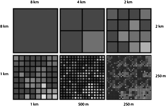
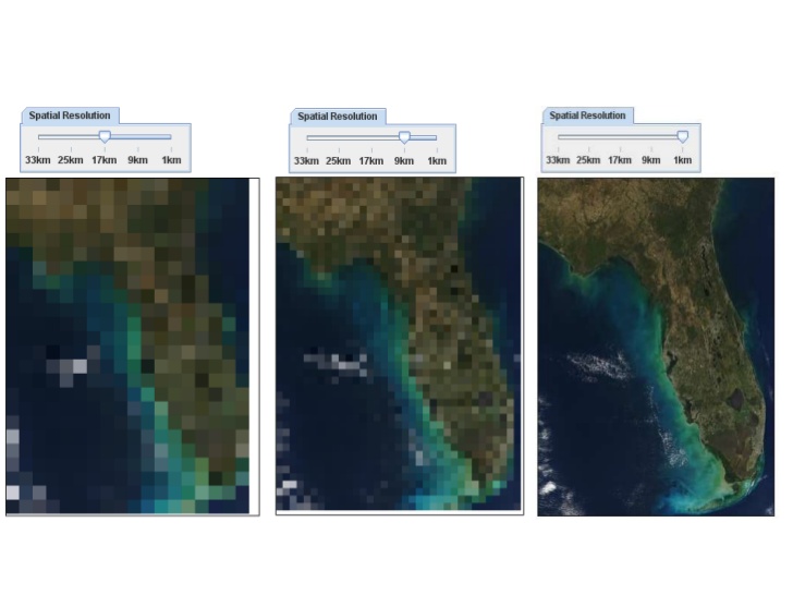
- Spatial resolution: the size of objects distinguishable on the Earth’s surface. A 1 km pixel resolution translates into everything in a 1x1km pixel being averaged.
Spectral resolution: the number and width of of spectral bands (wavelengths of the electromagnetic spectrum) in which the sensor can collect reflected radiance.
- High spectral resolution: 220+ bands (hyperspectral)
- Medium spectral resolution: 3 – 15 bands (multispectral)
- Low spectral resolution: 3 bands (red, green, blue- still multispectral)

- Temporal resolution: revisiting frequency of a satellite sensor for a specific location
- High temporal resolution: < 24 hours – 3 days
- Medium temporal resolution: 4 – 16 days
- Low temporal resolution: > 16 days
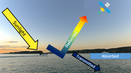
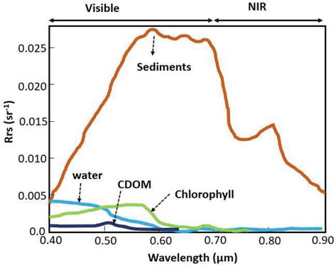
Inherent optical properties (IOPs) are substances in the water that affect the optical properties. When sunlight hits water, it is either absorbed by matter in the water, reflected off the surface, or transmitted/scattered through the water column.
The main water constituents that affect inherent optical properties include:
- Water itself- it has a specific optical spectrum!
- Phytoplankton (algae) pigments
- Colored (or chromophoric) dissolved organic material (CDOM)
- Non-phytoplankton inorganic particles (i.e. suspended sediment)
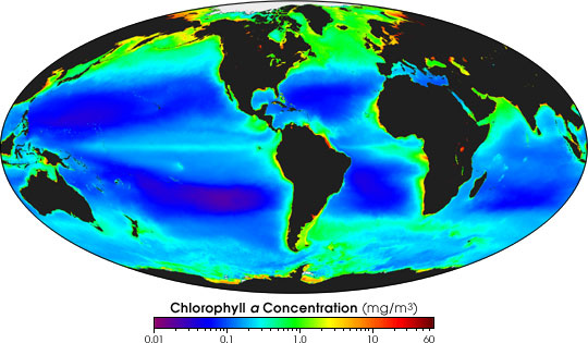
Why do scientists remotely sense chlorophyll?
All plants (including phytoplankton or algae) contain a green pigment called chlorophyll to capture energy from the sun in order to drive photosynthesis. Although most phytoplankton are microscopic, they can bloom in such large numbers that they can be detectable from space. Oceanic phytoplankton contributes to almost half of the world’s net primary production of biomass and therefore represents a significant component of the global carbon cycle. Therefore, measurements of chlorophyll from satellites provide the basis for the first large-scale estimates of oceanic net primary production, providing valuable information on how much carbon dioxide the oceans are absorbing and storing.
Stay tuned for my next blog which will go more in depth on the various ocean color satellite sensors!

[…] my first of three satellite remote sensing blog posts, I gave an overview of remote sensing basics, defined […]
LikeLike
[…] estuary or lake? The spatial resolution (i.e. the size of the pixels) can be important. See my first remote sensing blog post about the importance of spatial […]
LikeLike